


5:50 pm update:
MEMC has three active outages at this hour, with just 2 members affected.
2:00 pm:
Thomasville neighborhood reporter Layan Abu Tarboush spoke with neighbors about a tree that fell during the early morning hours. She reports that Thomas County power has been restored after outages early in the morning.
Meanwhile MEMC now lists 8 outages affecting 91 customers. The county administrator says the peak number of Mitchell County customers without power was 225 overnight.
1:15 pm:
MEMC reports that it is down to 7 active outages, with 85 customers affected.
The Mitchell County administrator tells us that as of now, there are no reports of injuries or deaths.
12:00 pm:
Sale City appears to be largely without power in the aftermath of the storm. Mitchell Electric Membership Corporation reports 11 active outages at this time, down from 15 earlier in the morning. The County Administrator says at least 95 homes are still without power.
In Thomasville, our Layan Abu Tarboush is looking into damage around Pine Tree Blvd.
11:44 am:
Our Kenya Cardonne is in Pebble City, where she has seen damage to a church, a fire station, a community house, and at least one home.


7:24 am:
NWS reports damage in Mitchell County where there was a radar indicated tornado this morning. Building damage and power lines are reported being down on GA Highway 37 and Sale City Road. There is also damage being reported in Pebble City.
6:17am:
Tornado warning issued for Mitchell County until 7am.
5:45am weather update:
NEW AT 2:30am:
The Tornado Watch has been extended to most counties within the Big Bend and southern Georgia until 10:00 a.m.

NEW AT 9pm:
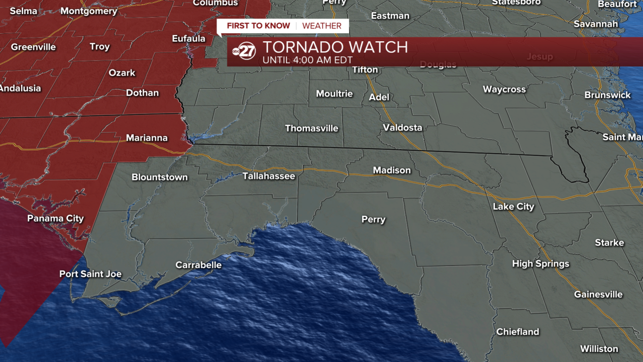
A Tornado Watch has been issued for the Florida Panhandle, including Jackson County.
This means conditions are favorable for producing tornadoes in the next few hours, but there is no immediate threat.

There is a 3/5 Enhanced Risk for severe weather in western parts of the Big Bend and South Georgia.
This extends from Sopchoppy, Tallahassee, Thomaville, and Moultrie westward, including all of Gadsden, Grady, Decatur, Miller, Baker, Mitchell, Liberty, Franklin, and Seminole counties.
If you're reading from Jackson County, this is where the threat increases to a 4/5 Moderate Risk. Severe storms are expected to be a little more widespread there.
This western zone is where the threat of damaging winds, hail, and some tornadoes is highest in our local area. This is where there is also the potential for stronger, long track tornadoes.
A silver lining remains in the fact that the line of storms will be weakening as they approach our area, meaning the risk for damaging storms is not as high as you may have seen west of us along the Mississippi River and parts of Alabama. However, don't let your guard down, as a potent severe weather maker is still expected to move through the area overnight.

If you're reading from eastern areas like Valdosta, Live Oak, Perry, Jasper, Madison, Nashville, Homerville, and Lakeland, these storms have a lower 2/5 threat for severe weather after 8am Sunday, but damaging winds, small hail, and even a brief tornado still cannot be ruled out.
TIMING:
Most showers and storms hold off until after midnight.

Around 2am we will start seeing a line of strong to severe storms roll through western parts of the area, which will begin ramping up the severe weather threat.

These storms move into the Tallahassee area between 4 and 7am, and linger into parts of the Suwannee River Valley late morning, closer to noon.
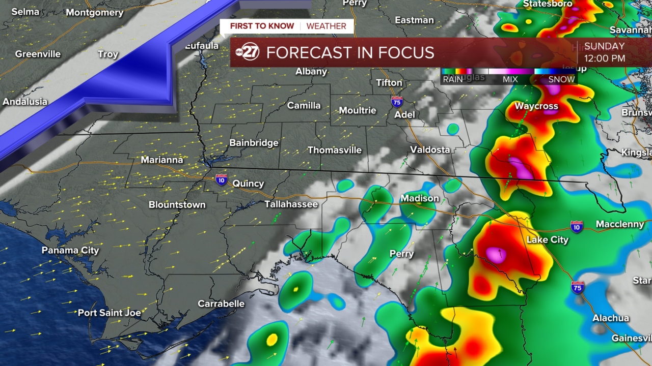
The severe weather threat will gradually diminish over the course of the morning.
Leon County Emergency Management has already sent out an alert notifying neighbors of the potential for severe weather with advice on how to prepare for the overnight storms and what to do if weather alerts are issued for your neighborhood.
If a tornado warning is issued later tonight, taking shelter in a basement is ideal.

If you do not have a basement, hunker down in a small, interior room on the first floor of your building. Do your best to stay away from exterior windows and walls.

If you are in a mobile home, the safest course of action is to go to a sturdier structure when a tornado watch is issued. This way, if a tornado warning is issued, you are already somewhere you can stay safe without traveling during a storm.
Want to see more local news? Visit the WTXL ABC 27 Website.
Stay in touch with us anywhere, anytime.
