TALLAHASSEE, Fla. (WTXL) — Subtropical Storm Patty has formed in the northern Atlantic and will impact the Azores and parts of the Iberian Peninsula with rough surf, wind, and rain this weekend into next week as it slowly weakens.
Patty is no threat to the Big Bend or South Georgia.

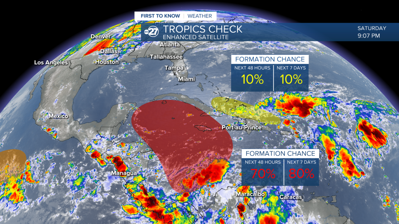
We are watching a separate system in the western Caribbean sea for likely development over the next few days. Within the next 48 hours there is a 70% chance for tropical development in the Caribbean, which increases to an 80% chance for development over the next 7 days.
This system will get the name Rafael if it forms.

This weekend, the system will begin to form in the western Caribbean.

The expectation is for a slow moving system in the Caribbean that gradually gains strength through the early to middle part of next week.

By the time the system enters the Gulf, there are two main factors we are looking at as to why the system will have a hard time strengthening, and possibly even maintaining the strength gets in the Caribbean.

1) Cooler Sea Surface Temperatures
Once sea surface temperatures drop below 80 degrees, there isn't as much fuel to get tropical systems going.

Now, 80 degrees is not the boiling point of water, but if you think of cooking noodles in a pot of water, what is going to cook the noodles more quickly and effectively? Water that has been brought to the boiling point or water that is just below the boiling point? That can be applied to hurricanes and tropical storms, the "boiling water", in this case 80 degree water (again both being examples of water temperature is not saying 80 degrees is boiling water), will help the storm blossom into a stronger system under ideal conditions. Without the source of strengthening being warm enough, that limits intensity.
2) Increased Wind Shear
The Gulf is expected to feature upper-level winds later next week with the potential for an approaching cold front and other atmospheric conditions. This disrupts the circulation or spin of a tropical system, which limits strengthening, and potentially weakens it.
Of course, we can't rule out the chance a weakening tropical storm approaches the area next week. This is why we will continue to watch the system. However, don't let anyone scare you into thinking a storm of the caliber of Helene or Milton will be heading this way.
Stay tuned to ABC 27 First To Know Weather for the latest.


