


Skies remain overcast with showers around this morning as low bottom out in the low to mid 70s. Overcast skies with some isolated showers make way for more widespread rain and thunder later this afternoon as a combination of a stalled front over the northeast Gulf and Hurricane Francine to our west come together to make for unsettled weather.
Francine is expected to make landfall as a Category 2 hurricane in Louisiana later today, helping to bring widespread rain to the Big Bend and South Georgia for your commute home from work. Highs reach the upper 70s and low 80s this afternoon while rainfall totals range from 1-4 inches across the area through Friday morning.
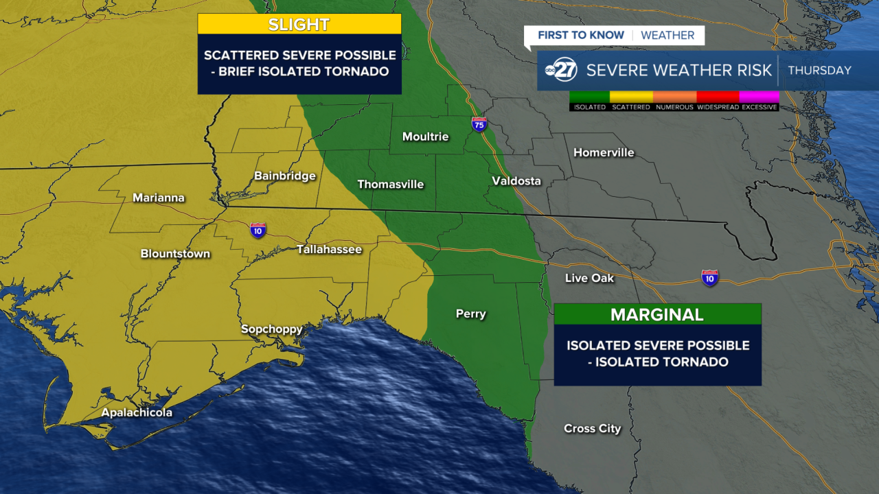
Overnight tonight into Thursday morning the outer bands of Francine will bring the chance for brief tornado spin-ups, especially in areas from Tallahassee and Thomasville west. Make sure you have multiple ways to receive alerts before heading to bed this evening in case a tornado warning is issued while you are asleep.
A little more sun finally peeks out from behind the clouds Friday as scattered thunderstorms remain in the forecast. A sun-cloud blend this weekend comes along with isolated afternoon storms before we begin to dry out heading into next week. Highs return to the upper 80s and low 90s this weekend with lows in the 60s and 70s.
