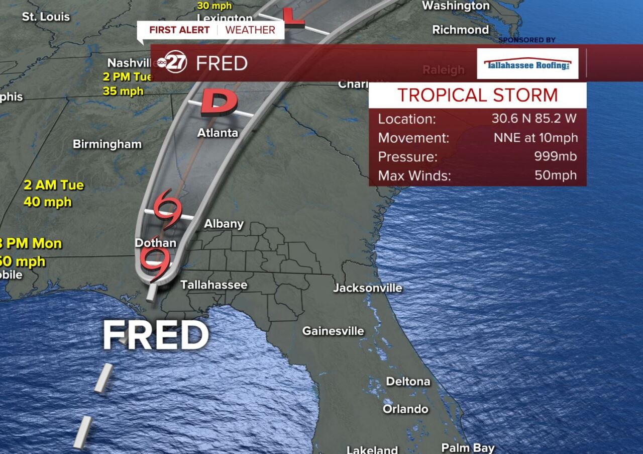
TALLAHASSEE, Fla. (WTXL) — NWS radar data indicates the center of Tropical Storm Fred has made landfall in Florida's eastern Panhandle. Maximum sustained winds are estimated to be near 65 mph.
Tropical Storm Fred's lengthy journey -- interrupted by earlier clashes with land -- made its final trip into the Florida Panhandle coastline Monday.

As of 8 p.m. Monday, the center of Fred was near Marianna, and peak winds were still around 50 mph.

A Tropical Storm Warning remains in effect for several tri-state and Big Bend counties. Occasional tropical-storm wind gusts are possible within the warning area later tonight.

A Storm Surge Warning has also been issued along the entire Big Bend coastline. Onshore wind flow will enhance water levels tonight in the eastern Big Bend coastline, with water levels rising up to five feet above normal water levels. Storm-surge water levels have decreased in the western Big Bend since reaching a peak earlier Monday.

Anywhere from two to seven inches of rain have fallen in the western coastal areas of the Big Bend, with lesser amounts east of US 319. About two to three more inches can fall inland in the tri-state area. A flash flood watch will stay in effect for the western half of the region through early Tuesday. Flash flood warnings have been issued for several areas near the Apalachicola River and Blountstown area through late tonight.

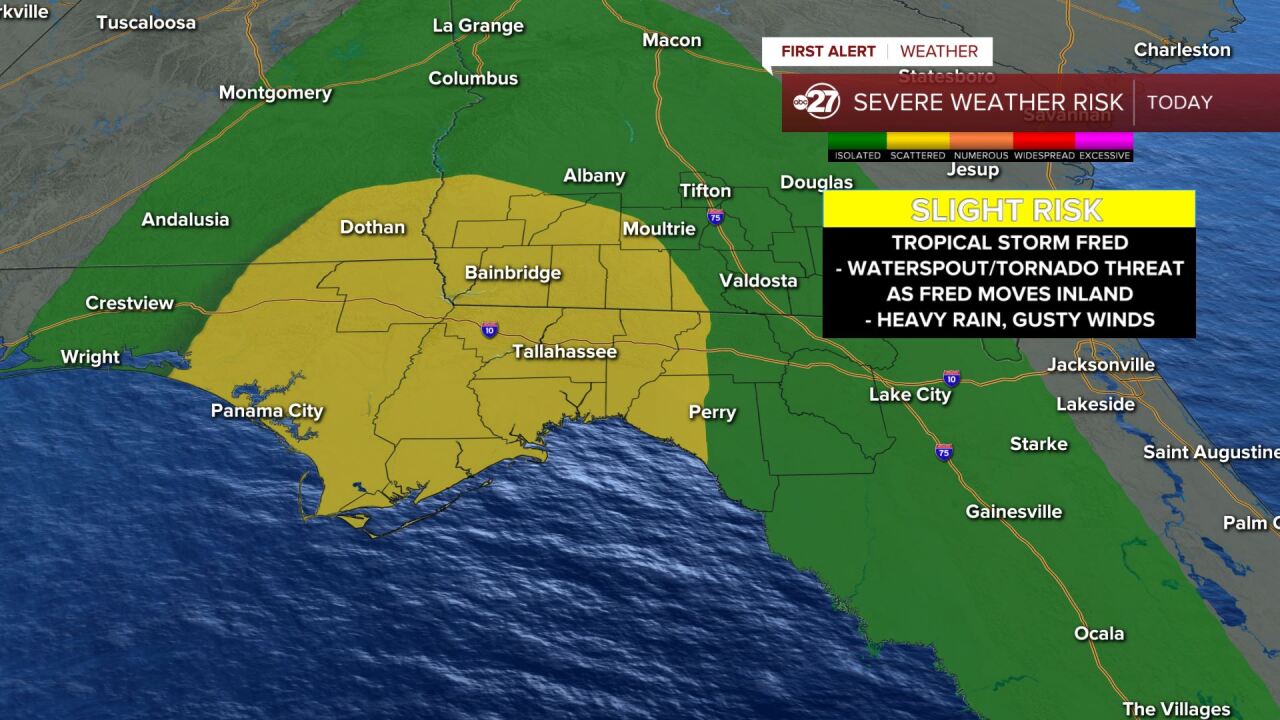
Rain bands reaching the central and eastern Big Bend have not formed confirmed tornadoes thus far, but a risk remains into the late-night for brief, fast-moving tornadoes within the rain bands. A tornado watch remains in effect until 10 p.m. for several Big Bend and southern Georgia counties.
As always, be sure to follow the ABC 27 First Alert Weather Team on Facebook and Twitter. Be sure to download the Storm Shield App to get watches and warnings delivered straight to your phone to stay updated on your forecast through the week. Get the app today: iPhone/iPad | Android.


